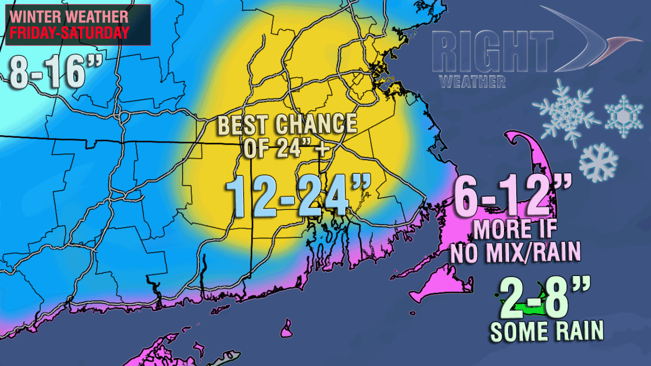
The traditional accumulation map, like below, is one way to look at a snowfall forecast. Another way to interpret it is by looking at the odds of reaching a certain snowfall amount, and the most likely odds of the final total being close to a certain amount. The graphs below will give you some insight into how confident we are in the snow forecast for the Providence metro area.
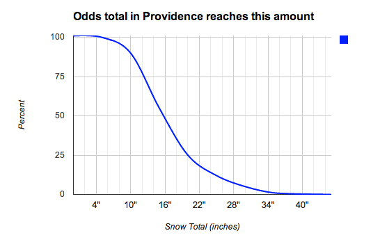
The graph above illustrates the odds of the final snow total reaching a certain amount. As you can see it’s virtually certain that the area will receive at least 8″ of snow. The odds are quite strong 75% or higher, that the total will be one foot. The 50% threshold is around 16″, but it does not drop off too quickly after that. There is a 25% chance of this storm bringing 20″ of snow to Providence – it would be the third storm since 1905 to reach that lofty total. There is even about a 10% chance of reaching the same total as the Blizzard of ’78 – the all-time greatest snow storm on record in Providence.
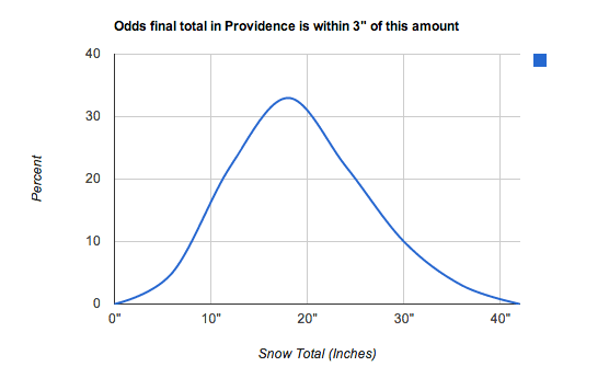 The graph above illustrates the odds of the final total in the Providence area being with 3″ of the amount depicted by the blue line. The peak of the graph represents the most likely total (within 3″) in the Providence area. The peak is close to 18″, so the most likely range for Providence is 15-21″, which corresponds well with the snow map below. Also, notice that the blue line crosses the 10% threshold at both 8″ and 30″. That means that there are equal (although low) chances of a total between 5-11″ and 27-33″. If none of that makes any sense to you, then there’s always the traditional accumulation map below.