Light snow flurries continue to fall in Southern New England Tuesday evening as the focus of the forecast turns to the potential for a significant winter storm on Friday. While that storm is still three days away, and its exact impact is unknown, the relatively benign weather in the forecast for the next couple of days may help to set the stage for the storm.
A weak Alberta Clipper is moving through the Great Lakes this evening. Ahead of it there is a bit of warmer air moving into the Northeast, and some light snow breaking out. Wednesday will be milder than Tuesday in Southern New England as the clipper moves into Northern New England. The high should be in the mid to upper 30s with some afternoon sunshine.
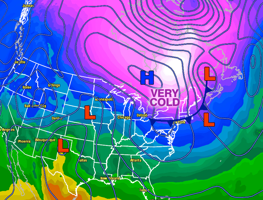
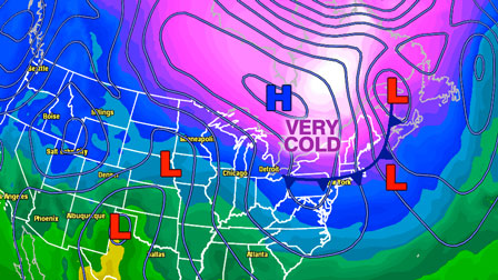
The clipper will drag a cold front to the south as it moves through Northern New England Wednesday night. That front should get all the way through Southern New England by Thursday morning. The air behind the front is very cold, and an area of high pressure will be nicely situated (if you like snowstorms) over Ontario and Quebec by Thursday morning.
The clockwise circulation around the area of high pressure will continue to funnel chilly air into New England Thursday. It looks mostly sunny with highs only in the upper 20s to low 30s in Southern New England. At the same time, separate disturbances in the northern and southern branch of the jet stream will be moving through the Central United States.
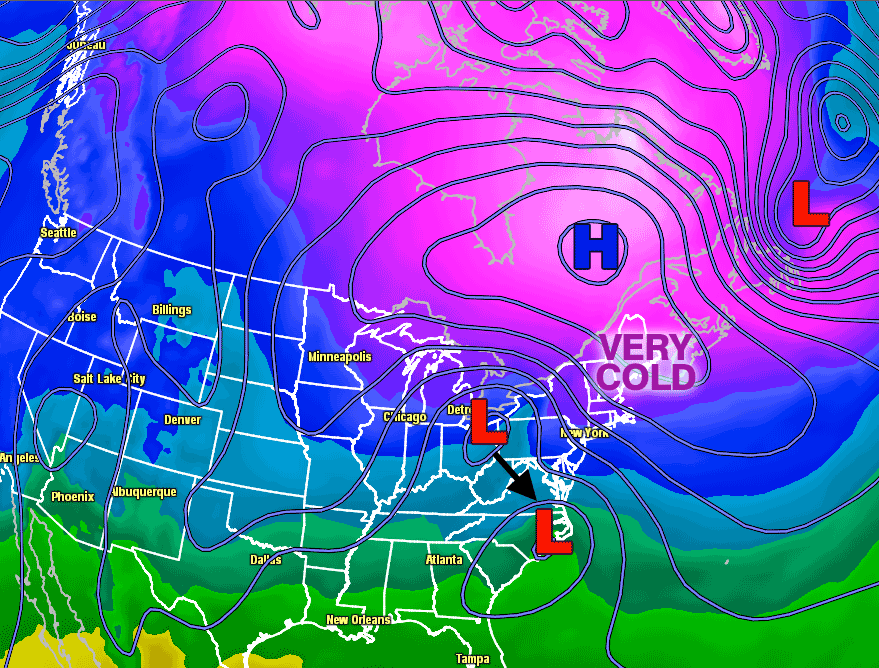
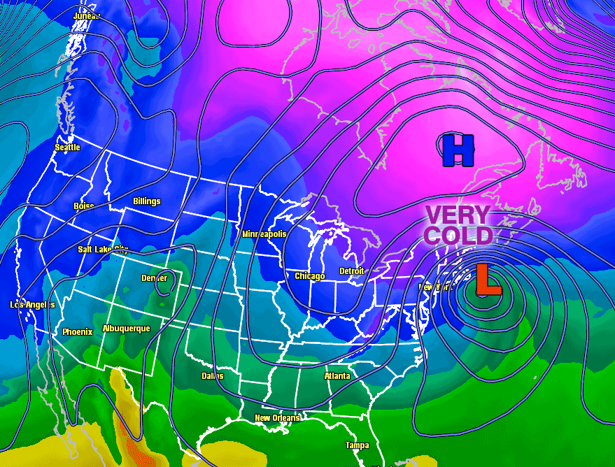
Thursday night into Friday morning as the disturbances near the coast the energy will be transferred from the northern branch system to a developing storm near Cape Hatteras. The two branches of the jet stream may come together perfectly (if you like snowstorms) to fuel the storm into a fast-intensifying Nor’easter that brings snow and strong wind to Southern New England Friday afternoon into early Saturday.
For more on the storm’s potential check the following links:


