A storm will impact Southern New England for the third straight weekend. The last two storms, both blizzards, have been predominantly snow for all of Southeastern New England. This time around, there are many questions surrounding the track of the system, and, ultimately, whether it brings snow, rain, or a mix to RI, MA, and CT.
Feel free to ask any questions in the comment section at the end of the blog. Click to enlarge all images.
A few things:
12Z run = 7 am EST initialization time
00Z run = 7 pm EST initialization time
QPF = Quantitative Precipitation Forecast (how much liquid precipitation falls – must convert for snow totals)
Most maps courtesy weatherbell.com
At this point, the odds favor both rain and snow in Southern New England, with the best chance of rain near the coast. The storm that is heading across the country in a very active weather pattern is likely to bring snow from the Southwest through the Plains to the Mid-Atlantic and New England. This will be one of several storms in the next 10-14 days to have a significant impact in the Eastern United States. Let’s find out what the latest computer model runs are predicting.

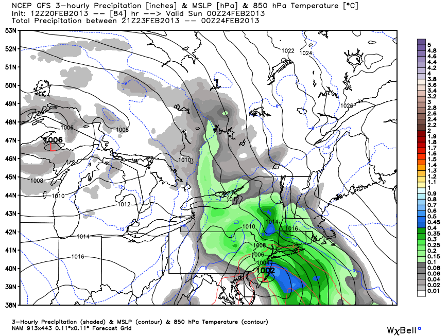
NAM (North American Model)
The NAM only goes out 84 hours, so we only catch a glimpse of the storm track and impact in Southern New England. Based on the 12Z 84 hour panel (7pm Sat) it looks like the storm will take a track close enough to the coast to go snow-rain-snow or snow-rain from the coast to the I-95 corridor.
The storm is over Atlantic City, NJ, with an easterly wind in Southern New England at 7pm Saturday. That is not a very favorable storm position or wind direction for the precipitation to remain as snow. The initial burst (front end thump) would probably be snow, especially inland, and a few inches could accumulate before the change to mix/rain from the coast to inland locations Saturday night. Of course, since the NAM ends at 7pm Saturday, it’s hard to know exactly where the storm is tracking, but, it looks like it’s heading too close to the coast for all snow.
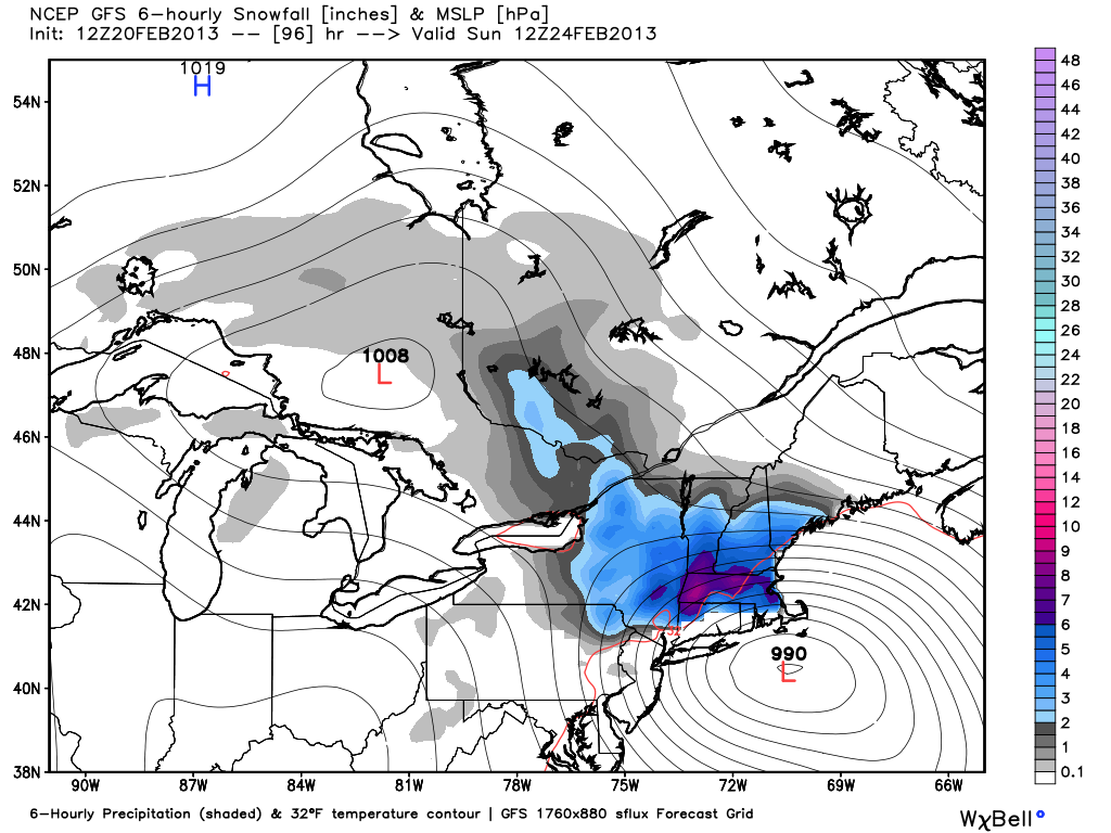
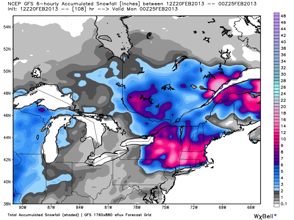
GFS (Global Forecast System)
The 12Z GFS has a very robust, moisture-laden storm that brings significant snow to interior New England Saturday night into Sunday. The storm track is close enough that the coast to I-95 goes from snow to rain to snow, with minor accumulations at the beginning and end of the storm. Farther inland, in Worcester for example, the snow really piles up. The QPF is about 1.5″ in Providence, but the bulk of it falls as rain with the temperature in the mid 30s. Worcester, however, remains all snow, and a foot is on the ground by mid-morning Sunday. At this point, even though the model favors rain near the coast for the bulk of the storm, it’s too early to say that this will not be a big snowmaker in Providence and Boston. In fact, Boston is even closer to the rain/snow line. Based on the 12Z run, Boston goes from snow to mix to snow, with about four messy inches of snow/sleet accumulating.