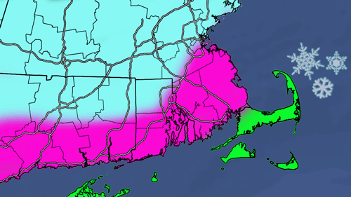
We have been telling you that a flip to much colder and more active weather was ahead for the end of December since early in the month. It looks like that pattern is really starting to take shape following the departure of the storm that is bringing blustery conditions and a few snow showers this weekend. A fast-moving storm is likely to bring a swath (love that word) of snow to the Mid-Atlantic and Northeast on Christmas Eve into Christmas Day. In Southern New England, the precipitation will likely be from after dark on Christmas Eve through mid-morning Christmas Day. The best chance of picking up accumulating snow is away from the coast as the storm tracks reasonably close to the shore. When looking at the map below, the highest odds of 4″ of snow is in Worcester County. The greatest chance of getting nothing in the 0-2″ area is near the coast.
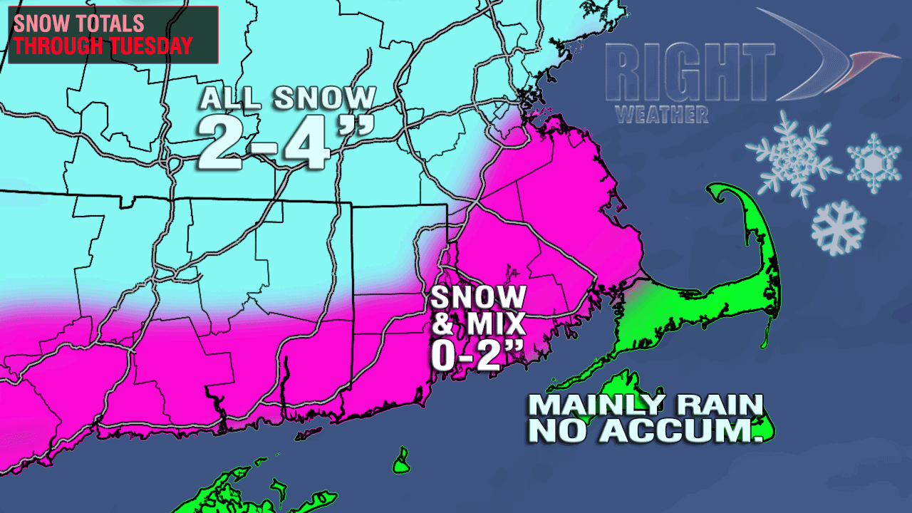
- Providence Metro area should see some snow before a possible change to mix or rain late Monday night
- Boston has a better chance of staying all snow
- A white Christmas is likely in NW RI where at least a couple of inches should accumulate
- If some of the more extreme computer model scenarios verify, the highest totals could be near 6″ inland
- A white Christmas is unlikely on the Cape and Islands because of the storm tracking too close to the coast
- The most uncertainty in the forecast is from the coast of RI and Buzzards Bay to Providence – right now, it looks like snow/rain with limited accumulation, but this area is very track sensitive


