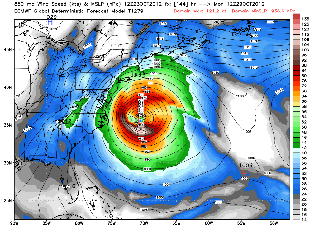
If there is one model to blame for all the Sandy hype, it’s the ECMWF. This model has been consistently bringing a major storm, 950mb or lower, to the Northeast. Unfortunately, this morning’s model run did not change much at all. By early Monday morning, the ECMWF has a 936 mb storm (fig. 4) east of Cape Hatteras. Think about that for a second: 936 mb. The normal central pressure for a Category 4 hurricane is between 920-944 mb. I know the storm will be centered over the warm Gulf Stream, but I will be shocked beyond belief if there is a storm that intense off Cape Hatteras on Monday morning. Even if this storm really explodes, I think we’re looking at a central pressure closer to 965 mb at that point. That would still be on the scale of a strong Category 2 storm.
The ECMWF then takes a 937mb storm into Eastern Long Island (fig. 5) at 8AM Tuesday. If this verifies, it would be far more destructive than Irene was last year, and, most likely, in the team picture for biggest storms of the past 100 years. It would be the most intense storm I, and many of you, have ever witnessed. Keep in mind, this is all theoretical. So much has to happen for Sandy to get to this point, and I don’t believe it will ever get to be this menacing of a storm. But, even if Sandy is 967mb instead of 937mb, a track across Long Island like the ECMWF is projecting would bring monster waves, a storm surge, tropical storm to hurricane force winds, and some heavy rain. That’s no picnic!
[twocol_one]

Thoughts on the model
The ECMWF has been consistent, but it is still farther west than most other models. The critical juncture for determining whether it is correct will likely be Friday or Saturday when the storm is in or leaving the Bahamas. While I think the GFS is too far east, I think the ECMWF may be too far west, and I’m nearly certain it is too intense with the storm. The track of the storm is plausible, the intensity seems grossly overdone. A couple more days of consistency from the ECMWF and the Right Weather threat level will go from storm possible to storm imminent.
Computer model graphics from weatherbell.com


