Everyone has heard of Post-traumatic Stress Disorder (PTSD), but how many have heard of PSSD (Pre-Sandy Stress Disorder). OK, I haven’t been clinically diagnosed, but I definitely have concerns as the storm approaches, and, I am sure I’m not alone among my fellow meteorologists. This storm has been an odd duck from the beginning. It took a while to get organized in the slow-cooker in the Southern Caribbean. It intensified between Jamaica and Cuba, weakened a bit over the Bahamas, and now it’s going to maintain its intensity as it heads for the Jersey Shore by mid to late Monday evening, but that doesn’t necessarily mean the forecast for Southern New England is as dire as it was on Saturday.
Most meteorologists I know get particularly anxious at this point when a potentially big weather event is on the doorstep. We know where it’s going, we know what the observations are, we know what the computer models say, but we’re not sure of the impacts. Did we miss something in the analysis? Are the winds going to be weaker or stronger than forecast. 60 mph gusts are not that big of a deal, 90 mph gusts are a very big deal. Did we do enough to prepare people, or did we over-prepare them, which would inevitably lead to all the overhype criticism. I can honestly say I haven’t watched a second of coverage, so I have no idea what’s being said on tv regarding the storm. I know what I’ve seen in the computer models. I know how unorthodox this weather setup is. I now that Sandy is a large and dangerous storm. I don’t know what the exact impact in the Mid-Atlantic and New England will be, but it will be bad for some. With that, here are some final thoughts on the forecast.

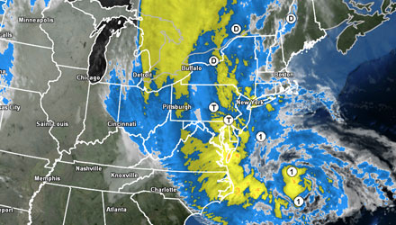
Hurricane Sandy Southern New England Forecast
Wind Potential A Bit Lower
It will start out breezy in Rhode Island and Massachusetts early Monday morning, and the wind will gradually increase during the morning. Tropical storm force (40+ mph) wind gusts will arrive between 8am-11am on Cape Cod and the Islands. The same wind gusts will reach the Rhode Island coast and Buzzards Bay between 10am-12pm. The first 40+ mph gusts are likely in Providence and Boston around noon. Scattered showers will occur in the gusty winds Monday morning.
The weather will continue to deteriorate, and a band of wind-driven rain is likely during the afternoon. That burst of wind and rain will be the worst that Sandy as to offer Southern New England. After reviewing some of the latest information, it does not look like we’ll see more than a 2-4 hour window for the peak gusts from the storm. As Sandy is evolving into a post-tropical cyclone, I believe that the weather on the other side of that strong wind, heavy showers band (or front) will not be nearly as rough and rugged. So, look for the peak wind gusts from Sandy between 1-5 pm in near the coast, and between 3-7 pm inland. Those peak gusts will likely be 65-80 mph near the coast, and 50-65 mph inland. That’s where a little bit of the uncertainty comes in. The low end of those scales, while still formidable, are not going to cause widespread damage with no foliage on the trees – and that’s a good thing. The higher end gusts of 65 mph inland, and 80 mph near the coast would lead to significant tree damage and power outage issues. The wind will decrease Monday night, and it will stay breezy to windy as Sandy spins down slowly over the Northeast until Thursday or so.
Coastal Flooding / Storm Surge – Moderate to Major Threat
This is the aspect of the storm’s forecast that I’m most confident in. While we can’t say exactly how high the surge will be, even the conservative estimates are similar to Irene, and on par with moderate flooding. Because of the Sandy’s size, there is going to be a huge area of high seas and big waves that crashes down on our shore. The storm is passing near high tide at the Rhode Island coast, and the full moon will further aid the rising water. I expect there to be damage in vulnerable areas near the bay and at the south coast from Sandy’s surge and waves combination. The worst of it will be tomorrow evening, but minor to moderate surges are possible at the surrounding high tides Monday and Tuesday morning.
Rain Potential – Few Heavy Showers
The forecast remains the same regarding Sandy’s rain potential. Sandy is likely not going to be a prolific rain maker in Southern New England. Aside from the heavy band of showers that comes through near the time of the strongest wind, we’ll just see scattered showers, which combined with the gusty breeze, will get you wet in a hurry. The final storm totals by the time Sandy’s last showers finally depart Wednesday or Thursday.
The Bottom Line
Unless something changes by mid-morning on Monday, I am going to back off the pedal just a bit on Sandy’s peak wind potential in Southern New England. The fact that Sandy’s inner core is hanging together will negatively impact the potential for widespread 75+ wind gusts at the coast of New England. That is good news. I think that Block Island, Cape Cod, Martha’s Vineyard, Nantucket, and possibly Buzzards Bay and the eastern MA coast have that potential, but I expect the coast of RI to see peak winds of 60-70 mph, and peak winds of 50-65 mph in the Providence to Northern Bristol County, MA area. In the northern part of RI and Worcester County, peak winds may only be 45-60 mph. Sandy’s coastal flood potential remains high and a significant threat to some vulnerable property.
The absolute worst of it may be on Western Long Island where the core of strongest winds should be located. Some 90+ mph gusts are possible as Sandy makes landfall with a pressure in the low to mid 940 mb range.
I also cut a video late Saturday night on Six Reasons Why Hurricane Sandy Scares Me. This is truly a unique, and maybe once in a lifetime storm.
- Follow all the updates on the Fred Feed Live Blog (Right Weather Pro subscription price has been dropped due to Sandy to $29.99 for a whole year of access)
- Download the FREE RightWX app for your Android or iOS device to stay informed if you lose power
- Interactive Hurricane Tracker
- Hurricane preparation tips
- Protecting your pets during a major storm


